4-4
Figure 4-2.—Elliptical satellite orbit.
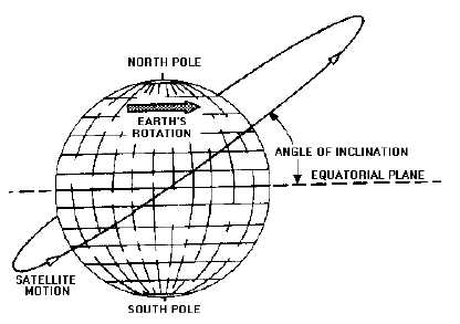
ANGLE OF INCLINATION.—The ANGLE OF INCLINATION (angle between the equatorial
plane of the earth and the orbital plane of the satellite) is the third parameter used to describe the orbit
data of a satellite. Figure 4-3 depicts the angle of inclination between the equatorial plane and the orbital
plane. Most satellites orbit the earth in orbital planes that do not coincide with the equatorial plane of the
earth. A satellite orbiting in any plane not identical with the equatorial plane is in an INCLINED ORBIT.
Figure 4-3.—Inclined satellite orbit.
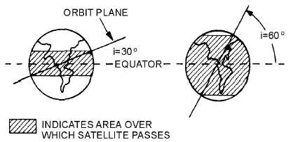
The inclination of the orbit determines the area covered by the path of the satellite. As shown in
figure 4-4, the greater the inclination, the greater the amount of surface area covered by the satellite.